Columbus’s 1498 Gulf of Paria voyage and the evidence of fresh water
During his 1498 voyage near Trinidad and Paria, Columbus encountered powerful currents and extensive fresh water. A historical account links these observations to his inference that a continental landmass lay nearby.
A voyage into an inhabited region
Columbus’s third transatlantic expedition reached Trinidad and the adjacent South American coast in 1498. These places already formed part of Indigenous worlds of settlement, travel and exchange. Calling the voyage a European encounter is therefore more accurate than treating it as the beginning of their history. The surviving European accounts describe people, canoes, food and trading contacts, although they filter those encounters through the voyagers’ own ambitions and assumptions.
The water as geographical evidence
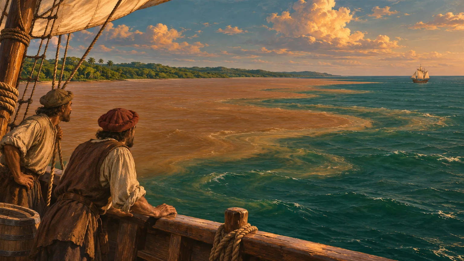
In the Gulf of Paria, the expedition encountered powerful flows and water described as fresh or sweet. The account preserved by Trinidad and Tobago’s national library connects the great extent of the gulf, rivers running into it and the freshened sea with Columbus’s eventual conclusion that there was continental land nearby. The reasoning depended on scale: such an extensive supply of river water implied a substantial area of land feeding it.
Observation did not erase older beliefs
This geographical inference did not mean Columbus possessed a modern map of South America or abandoned his wider ideas about Asia. The Library of Congress explains his continued commitment to an Asian interpretation of his voyages. The Paria account likewise mixes observations with religious and inherited geographical arguments. The episode illustrates how a useful conclusion can emerge within a larger framework that remains mistaken. New evidence does not always replace every older assumption at once.
Reading the account critically
The national-library document reproduces passages from the biography attributed to Columbus’s son Ferdinand, in an English version printed in 1704. It is valuable evidence for the voyage’s remembered observations, but it is not a neutral modern scientific log. Its language about Indigenous people and imperial possession requires critical reading. The year 1498 is used for the exploratory episode rather than assigning one unsupported day to a developing inference. The illustration interprets mixing waters and period ships; its coastline and colours are explanatory choices, not an archival view.
Calyps’Atlantic Steelband — One For Trinidad (2004)
Calyps’Atlantic Steelband
Jason Baptiste’s modern composition for this steelband connects through Trinidad’s later musical culture. Steelpan belongs to a much later history; this is a geographical association, not music from the 1498 voyage.
Listen on SoundCloud ↗Follow the evidence.
- NALIS: historical account of the Trinidad and Paria voyage ↗
- Library of Congress: Columbus and the Taíno ↗
- SoundCloud: Calyps’Atlantic Steelband — One For Trinidad (2004) ↗
AI-assisted writing, with institutional and primary sources. Illustration is a reconstruction, not an archival photograph. Published November 3, 2026; updated November 3, 2026. Our approach